|
| *****SWAAG_ID***** | 41 |
| Date Entered | 10/01/2011 |
| Updated on | 26/08/2011 |
| Recorded by | Stephen Eastmead (admin) |
| Category | Enclosure |
| Record Type | Archaeology |
| Site Access | Public Access Land |
| Record Date | 13/07/2010 |
| Location | Calver Hill |
| Civil Parish | Reeth |
| Brit. National Grid | NZ 002 005 |
| Altitude | 409m |
| Record Name | Prehistoric Enclosure |
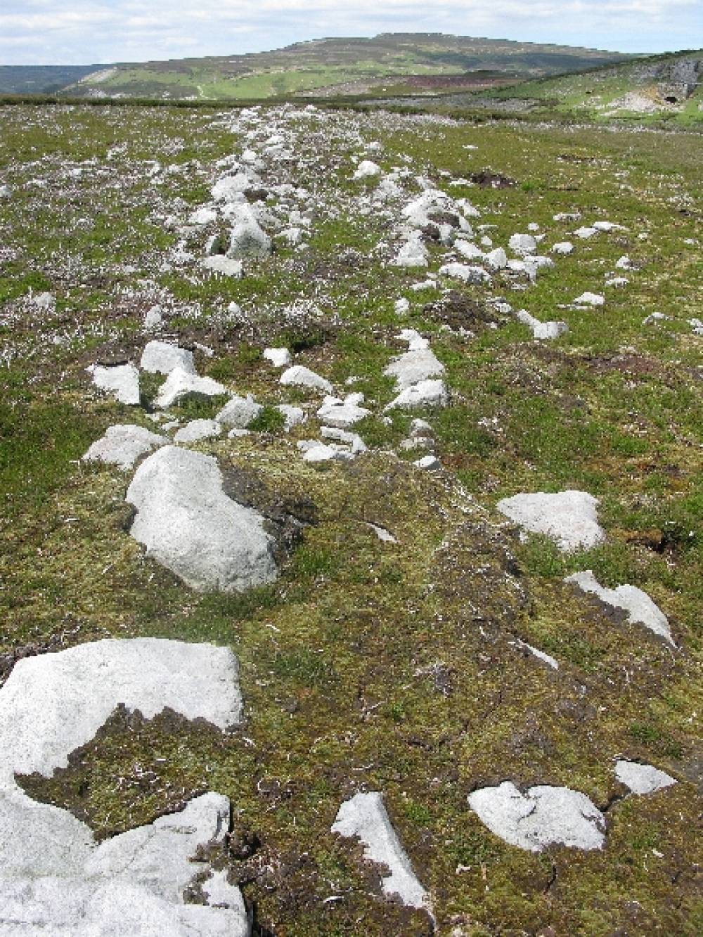
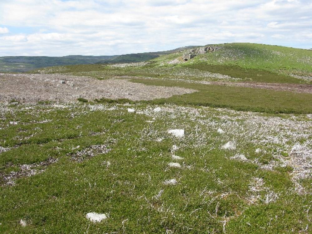
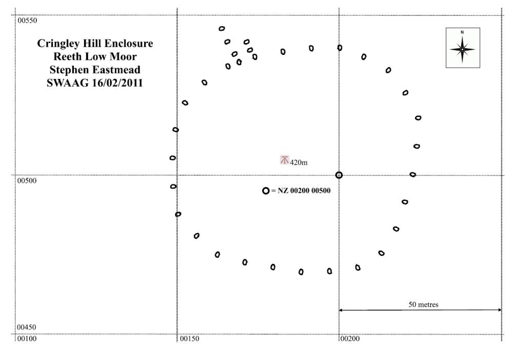
| Record Description | Reported by Doug Waugh (non-member) Description by Tim Laurie The feature shown on the photos is the large sub-circular enclosure located some 200m east of the lime kiln on Cringley Hill, Reeth Low Moor, at .This enclosure is shown on the OS 1:25000 Scale Map. All the archaeological features on Calverside West including this area of Cringley Hill and on the moorland on the northern slopes of Calver Hill which include unenclosed settlements, (e.g. the 'hut circle' on the OS map) together with field system, enclosures, lithic finds and burnt mounds, were surveyed during the Swaledale Land Boundaries Project, whose reports can be found here. Please refer to 'Coaxial field systems in Swaledale. A reassessment. Figure 7: Calverside West' for the first published detailed archaeological survey of Reeth Low Moor, West. The large enclosure (top photo) on Cringley Hill is well known best interpreted as a cattle kraal. Lower photograph shows one of the field systems with the lime kiln in the background. |
| Image 1 ID | 58 Click image to enlarge |
| Image 1 Description | Image from Doug Waugh | 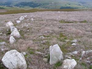 |
| Image 2 ID | 59 Click image to enlarge |
| Image 2 Description | Image from Doug Waugh | 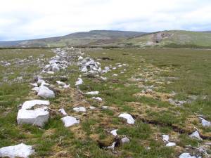 |
| Image 3 ID | 60 Click image to enlarge |
| Image 3 Description | Additional image from Ric Carter |  |
| Image 4 ID | 61 Click image to enlarge |
| Image 4 Description | Additional image from Ric Carter | 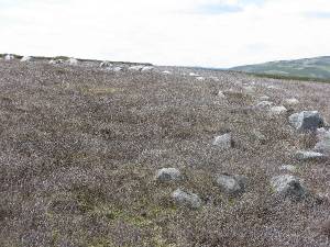 |
| Image 5 ID | 62 Click image to enlarge |
| Image 5 Description | Additional image from Ric Carter | 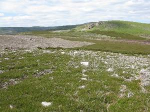 |
| Image 6 ID | 293 Click image to enlarge |
| Image 6 Description | SWAAG Map 16/02/2011 | 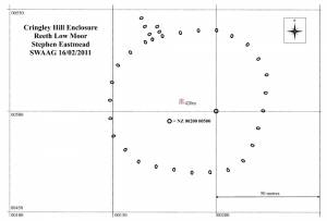 |